Browse All Palestine Webcams

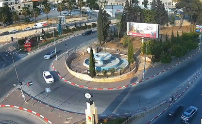
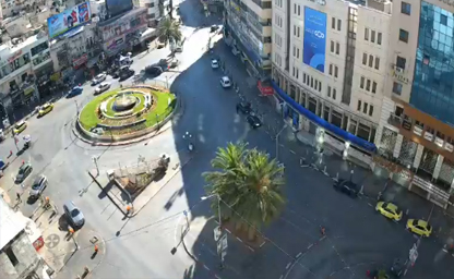
Live Webcams - IpLiveCams Martyrs' Roundabout

Martyrs' Roundabout

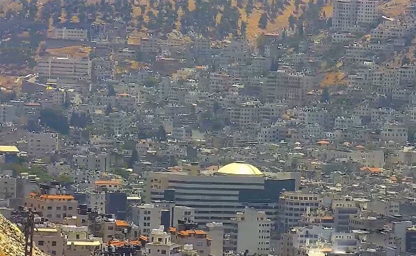
A partial view of the city-centre

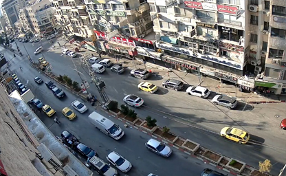
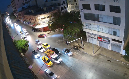
Live Webcams - IpLiveCams Al Malek Faisal

Al Malek Faisal

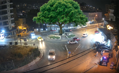
The main street of the miniature Old City of Nablus

Live camera installations in Palestine have been increasingly used both for strategic purposes (e.g., traffic and security monitoring) and to promote tourism by offering virtual access to key sites. This article provides an overview of common deployments in strategic locations as well as tourist-oriented live streams, highlighting their rationale, typical configurations, benefits, and challenges—all without referencing specific external documents or sources.

1. Strategic Installations

1.1 Traffic and Urban Monitoring

Key Urban Centers

Municipalities in cities such as Ramallah, Nablus, and Hebron may deploy cameras at major intersections, roundabouts, and arterial roads. These live feeds help traffic management teams observe congestion patterns in real time, adjust signal timing, and respond swiftly to incidents or accidents. In denser urban neighborhoods, cameras can also support pedestrian safety efforts by monitoring crosswalk usage and identifying potential conflicts.

Rural and Peri-Urban Roads

On highways and rural connectors, live cameras can serve early-warning functions for emergencies (e.g., accidents, severe weather) and assist road maintenance crews in prioritizing interventions. Where road conditions vary seasonally, feeds can help authorities decide where to dispatch crews for snow removal, flood response, or clearing debris after storms.

1.2 Security and Situational Awareness

Critical Infrastructure Protection

Cameras placed near water treatment facilities, power substations, or communication hubs provide a continuous view of perimeters and access points. Security teams can detect unauthorized access attempts, respond rapidly to alarms, and maintain logs of relevant events. In contexts where physical security is paramount, such deployments often integrate motion analytics and automated alerting.

Border Crossings and Checkpoints

Strategic installations at border areas or checkpoints frequently include live streams (accessible internally by authorized personnel) to monitor queue lengths, detect unusual activity, and coordinate responses among different agencies. These camera feeds can also support humanitarian organizations in planning resource allocation when flows of people vary.

Emergency Response Coordination

During natural disasters or large public gatherings, live camera feeds support emergency operation centers by offering situational awareness: identifying crowd movements, locating areas in need of assistance, and tracking the progress of response teams. Integration with mapping interfaces helps decision-makers deploy resources efficiently.

1.3 Environmental and Public Safety Monitoring

Flood-Prone Zones and Weather Events

Cameras installed in valleys, wadis, or near riverbeds can provide visual data during heavy rains or potential flooding, enabling early warnings and public advisories. Live feeds shared with relevant authorities and sometimes the public help communities take precautionary measures in advance.

Urban Health and Hygiene

Some installations focus on monitoring waste collection points, public parks, or marketplaces for crowd density and hygiene conditions. These live streams can assist municipal services in scheduling cleaning rounds, placing sanitation resources, and ensuring compliance with health regulations, especially during public events or high-traffic seasons.

Environmental Observation

In areas of ecological interest—such as nature reserves or protected archaeological sites—live cameras can serve dual purposes: providing researchers or park managers with continuous observation of sensitive zones, and offering virtual access to the public, thereby reducing foot traffic while sustaining interest.

2. Tourist-Oriented Live Cameras

2.1 Religious and Heritage Sites

Bethlehem and the Church of the Nativity Area

Many tourism portals and local operators host live cameras overlooking Manger Square or adjacent streets, allowing virtual visitors worldwide to observe pilgrim flows, special events (e.g., Christmas celebrations), and daily life around this renowned landmark. These streams foster engagement among diaspora communities and those planning future visits.

Hebron’s Old City and Tomb of the Patriarchs Vicinity

Live feeds positioned to capture the ambience of the Old City’s streets or view the vicinity of significant religious sites provide remote access to the area’s historic architecture and cultural dynamics. Such streams can promote awareness of local heritage and encourage responsible tourism planning.

Jericho and Nearby Archaeological Zones

Some cameras give a panorama of Jericho’s oasis landscape or overlook archaeological points of interest. By showcasing sunrise or sunset views over ancient ruins, these feeds enrich travel planning resources and academic interest, while minimizing physical disturbance to delicate sites.

2.2 City Panoramas and Scenic Vistas

Ramallah or Nablus Cityscape

Panoramic cameras mounted on rooftops or high points in cities like Ramallah or Nablus reveal urban life rhythms: markets awakening in the morning, street activity, and the interplay of modern and traditional architecture. Such vistas make compelling virtual postcards for potential visitors.

Dead Sea Shoreline Views

Live cameras overlooking the Dead Sea’s shoreline capture changing water levels, atmospheric conditions, and visitor areas. These streams inform tourists about current weather, crowding, and scenic qualities, aiding in trip planning and safety considerations (e.g., swim advisories when conditions shift).

Mountainous or Valley Overlooks

Cameras installed at vantage points in hilly areas, such as near popular hiking trails or lookout points, provide real-time glimpses of landscape conditions, weather visibility, and trail usage. This supports outdoor enthusiasts in choosing suitable times for excursions.

2.3 Cultural Events and Festivals

Special Celebrations and Pilgrimages

During festivals or religious celebrations, temporary or fixed cameras may stream processions, ceremonies, or communal gatherings. These feeds extend participation to those unable to attend in person and can help organizers manage crowd safety by monitoring density and movement patterns.

Seasonal Markets and Fairs

Live coverage of traditional markets—handicrafts fairs or food festivals—enables artisans and vendors to showcase activities remotely, attracting broader audiences and potential buyers. Viewers gain insights into local crafts and culinary traditions, fostering cultural appreciation.

3. Technical Considerations

3.1 Infrastructure Requirements

Network Connectivity

Live camera feeds in both urban and remote areas rely on stable network links. Urban deployments often use wired broadband or fiber, while rural or isolated vantage points may depend on wireless point-to-point links, cellular routers, or satellite backhaul. Bandwidth provisioning must account for resolution and frame rate demands.

Power Supply and Resilience

Cameras in public or remote installations require reliable power. In many locations, grid instability necessitates backup solutions: UPS units, solar panels with battery storage, or generator support. Weatherproof and tamper-resistant enclosures protect equipment from environmental stressors and unauthorized access.

3.2 Camera Selection and Placement

Resolution and Optics

For tourist-facing streams, higher-resolution cameras enhance the virtual experience by revealing architectural details and scenic subtleties. Strategic or security-oriented feeds may balance resolution with bandwidth/storage constraints, often leveraging motion-triggered higher-bitrate clips for later review.

Mounting and Field of View

Optimal placement considers line-of-sight, lighting conditions (day/night performance), and avoidance of glare or obstructions. Panoramic or PTZ units can cover broader areas but may require more complex control logic. Fixed wide-angle lenses often suffice for cityscape or scenic views.

3.3 Video Management and Streaming Platforms

Hosting and Distribution

Live streams may be hosted on municipal or tourism websites, social media platforms, or specialized webcam portals. Content delivery networks (CDNs) can help handle peak viewer loads during high-demand times (e.g., festivals or sunrise events at scenic spots).

User Interface and Accessibility

Embedding live feeds within interactive maps or tourism portals enhances usability. Mobile-friendly interfaces ensure that remote audiences on smartphones or tablets can easily view real-time scenes. Some platforms offer time-lapse playback or archives for retrospective viewing.

3.4 Privacy, Ethics, and Permissions

Legal and Community Engagement

Prior to deploying live cameras, operators often engage with local stakeholders (residents, community leaders, property owners) and comply with applicable regulations. Signage informing passersby of live streaming may be installed. For sensitive areas, views may be restricted or blurred to protect privacy.

Data Retention and Security

While many tourist-focused streams run continuously without storing long-term footage, strategic or security installations typically incorporate storage policies, secure access controls, and encryption to safeguard recorded material. Operators define retention durations aligned with operational and legal requirements.

4. Benefits and Impacts

4.1 Tourism Promotion

Virtual Engagement

Live cameras offer potential visitors a real-time glimpse of sites, helping them decide travel plans and generating interest. Diaspora communities often appreciate seeing hometown scenes, enhancing cultural connection and tourism appeal.

Economic Uplift

Increased visibility can attract visitors, boosting local businesses (hotels, restaurants, tour guides). Virtual streams may be monetized indirectly through partnerships, sponsorships, or promotional campaigns.

4.2 Operational Efficiency

Municipal Services

Traffic or environmental monitoring feeds assist local authorities in resource allocation—dispatching maintenance crews, adjusting traffic signals, or issuing public advisories. Real-time visibility helps reduce response times to incidents or emergencies.

Security and Safety

Strategic feeds improve situational awareness for security or emergency responders, enabling quicker interventions and coordination. Communities may feel reassured knowing that monitoring exists for key public areas.

4.3 Community and Cultural Engagement

Accessibility and Inclusion

Live streams allow people with mobility constraints or those far away to virtually “visit” important cultural and religious sites. Educational institutions can use feeds in curricula to illustrate history, architecture, or geography.

Crowdsourced Reporting

Publicly accessible live cameras sometimes empower citizens to report hazards (e.g., fallen debris, traffic blockage) in near real time. When integrated with community apps, such feeds support collaborative problem-solving.

5. Challenges and Considerations

5.1 Technical and Infrastructure Constraints

Connectivity Gaps

In areas with limited or unreliable internet, live streaming quality may suffer. Operators might adopt adaptive bitrate streaming or schedule lower-resolution feeds. Backup connectivity (e.g., cellular failover) can mitigate outages but may incur additional costs.

Power Stability

Frequent power interruptions require backup solutions (solar, batteries) and robust enclosures to protect against voltage fluctuations. Remote sites may be harder to maintain due to access restrictions or security concerns.

5.2 Political and Security Sensitivities

Permissions and Approvals

Deploying cameras in areas with complex administrative or security dynamics often involves negotiating with multiple authorities and ensuring compliance with regulations. Operators must be aware of local sensitivities regarding surveillance.

Risk of Damage or Tampering

In zones prone to conflict or vandalism, cameras can be at risk. Protective housings, tamper-evident features, and rapid-replacement plans help maintain continuity. Sometimes temporary deployments (e.g., for specific events) reduce exposure to long-term risk.

5.3 Privacy and Ethical Concerns

Balancing Visibility and Privacy

While live views can benefit tourism and operations, they must avoid revealing private spaces or capturing individuals in sensitive contexts. Appropriate framing, masking, or limiting angles helps address privacy. Community consultation ensures acceptance.

Data Governance

Cameras that record or store footage require clear policies on access control, retention, and deletion. For tourist-facing streams, long-term storage is often unnecessary; for security feeds, strict safeguards must be in place.

6. Future Directions

6.1 Integration with Mobile Apps and Social Platforms

Embedding live feeds into mobile tourism apps or social media channels can widen reach and offer interactive features (e.g., live chat, event alerts). Augmented reality overlays might combine live imagery with historical or cultural context in real time.

6.2 Advanced Analytics and AI

For strategic installations, incorporating on-camera analytics (e.g., automated incident detection, crowd density estimation) can reduce operator workload and improve responsiveness. Careful configuration ensures analytics respect privacy norms (e.g., avoiding unauthorized facial recognition).

6.3 Community-Led Initiatives

Local communities or NGOs may host their own camera projects to highlight cultural activities, environmental conditions, or grassroots events. Crowd-funded or cooperative models can foster local ownership and ensure that live streams serve community-defined goals.

6.4 Sustainability and Green Technologies

Future deployments may leverage low-power cameras, solar energy, and edge computing to minimize carbon footprint and operating costs. Energy-efficient hardware and intelligent power management extend uptime in areas with unstable grids.

Conclusion

Live camera installations in Palestine serve both strategic needs (traffic management, security, environmental monitoring) and tourism promotion (virtual access to heritage sites, city panoramas, festival coverage). While benefits include enhanced situational awareness, economic uplift, and broader engagement, challenges such as infrastructure limitations, security sensitivities, and privacy concerns must be addressed proactively. By combining robust technical design, community involvement, clear governance, and resilient operations, stakeholders can deploy and maintain live camera systems that enrich both local well-being and the visitor experience.

History

The lands known historically as Palestine have been a crossroads of civilizations for millennia, leaving an intricate tapestry of cultural layers that a traveler can still trace today. Ancient settlements emerged in this region long before written records, with communities taking advantage of fertile valleys and trade routes connecting Africa, Asia, and Europe. Stone tools and pottery fragments uncovered at archaeological sites reveal societies engaged in agriculture, animal husbandry, and early craft production. Over time, city-states and small kingdoms arose, each leaving traces in ruins of fortifications, temples, and water systems. Visitors exploring hilltop tells can imagine the rhythms of daily life in Bronze and Iron Age villages, where olive presses and granaries marked communal activity.

With the arrival of successive empires, the region’s identity continually evolved. Under imperial administrations, grand infrastructure projects—roads, aqueducts, administrative centers—brought new technologies and linked local communities into broader networks. Remnants of Roman-era colonnaded streets, Byzantine churches, and mosaic floors speak of periods when commerce and religious pilgrimage coexisted. Travelers can still wander among the remains of ancient theaters, bath complexes, and fortified crossroads, each structure hinting at the interplay between local traditions and imperial ambitions.

In the early medieval centuries, the region witnessed the rise of new cultural and religious influences. Caravan routes threaded through desert margins, connecting inland oases to coastal ports. Fortresses perched on strategic heights testify to an era when control of trade paths and water sources was vital. Mudbrick dwellings and stone-built towers illustrate how communities adapted to shifting political realities while preserving agrarian and artisanal ways of life. Historic marketplaces, sometimes still active today, reflect centuries-old crafts: woven textiles, glazed ceramics, leather goods, and metalwork that blend aesthetic continuity with functional design suited for local climate and social customs.

The medieval period also saw periods of turmoil and reconstruction. Castles and watchtowers on hill ridges mark the zones of contest between rival forces, while caravanserais and pilgrimage lodges indicate routes taken by merchants and devotees. Walls built to protect towns rise above modern streets, their stones bearing witness to sieges and rebuildings. Travelers who navigate narrow alleys can sense how communities recuperated from conflict by reviving agriculture, maintaining water cisterns, and reestablishing markets. In some villages, ancient olive trees still stand as living monuments to resilience and continuity across generations.

Under Ottoman rule, administrative reforms influenced land tenure and taxation, shaping rural settlement patterns. Large estates and smaller peasant holdings coexisted, with villages clustered around arable terraces and water sources. Caravan routes gave way gradually to early modern roads, improving access between inland regions and coastal ports. Ottoman-era architecture—courtyards with cisterns, stone houses with vaulted ceilings, caravanserais repurposed as communal centers—can be encountered in towns whose narrow lanes preserve the rhythm of past centuries. In urban centers, mosques, khans, and public baths illustrate the daily interplay of spiritual, commercial, and social life. Visitors discovering these spaces often find local guides recounting oral histories: family lineages tied to particular crafts, agricultural cycles shaped around olive and fig harvests, and seasonal festivals marking communal solidarity.

When the 19th and early 20th centuries brought new influences—modern roads, railway proposals, and administrative changes—local communities adapted again. Some towns expanded with stone-built civic structures: municipality offices, schools, and marketplaces reflecting architectural blends of local design and imported styles. Agricultural innovations introduced modern irrigation where water could be channeled, but many farmers continued traditional terracing and rainwater harvesting, techniques perfectly suited for hillside cultivation. Travelers exploring rural byways encounter small farms where centuries-old olive groves coexist with newer orchards, reflecting an ongoing dialogue between heritage and evolving practices.

The period of transitional governance in the early 20th century left its own marks: remnants of military posts, rail embankments, and bridges hint at strategic considerations, while older urban quarters persisted as centers of family life. In some towns, British-era buildings—stone villas, administrative offices—sit alongside older Ottoman structures and modern concrete developments. Navigating these urban fabrics, a visitor senses both complexity and continuity: marketplaces where spices, textiles, and handicrafts trade hands much as in earlier times, yet conversations now include contemporary concerns of heritage preservation and sustainable development.

Modern history in the region has seen rapid changes in demographics, infrastructure, and urban expansion. Cities grew, absorbing surrounding villages, creating urban mosaics where historic cores with narrow alleys and ancient walls lie adjacent to broad avenues and modern residential neighborhoods. New museums and interpretation centers have arisen to curate and present archaeological finds, oral traditions, and evolving artistic expressions. A traveler attuned to local narratives can engage with guides who share multi-generational memories of family farms, crafts passed from elders, and the stories of rebuilding after disruptive events. This layering of past and present invites reflection on how communities preserve identity through foodways—olive oil production, bread baking in traditional ovens, harvest festivals—and artistic forms like embroidery, pottery, and music that echo age-old motifs while incorporating contemporary inspirations.

Throughout these eras, religious and cultural diversity shaped daily rhythms: sacred sites for different faith traditions coexist in close proximity, pilgrimage routes converge on ancient shrines, and festivals follow lunar or agricultural calendars. A sensitive traveler observes how processions or gatherings around these sites carry forward centuries-old practices, even as infrastructure around them—roads, lighting, visitor facilities—evolves to accommodate modern pilgrimage and tourism. The result is a tapestry where stones whisper stories of ancient traders, pilgrims, and farmers, and where each generation adds its own chapter without erasing the traces beneath.

Climate

The region’s climate spans Mediterranean patterns to more arid zones, creating diverse experiences for travelers depending on season and locality. Coastal plains receive moderate rainfall in winter months, with dry, hot summers that encourage seaside activities and early-morning exploration before temperatures peak. Inland highlands exhibit cooler winter temperatures and occasional frost at higher elevations, while summer days can be warm but tempered by elevation-related breezes. In valley areas, especially those lying below sea level or in deep depressions, summer heat intensifies, requiring travelers to plan outdoor excursions in early or late parts of the day and to carry sufficient water and sun protection.

Seasonal rainfall typically falls between late autumn and early spring, nourishing olive groves, cereal fields, and wild vegetation that carpet hillsides in green during late winter and early spring blooms. Traveling in these months offers vibrant landscapes: hills dotted with flowering shrubs, terraces washed in green hues, and moderate temperatures ideal for hiking and visiting rural villages. By contrast, summer months bring long, dry spells, when irrigation sustains agriculture but wild vegetation retreats to hardy shrubs. Coastal breezes offer relief along the shore, making seaside promenades or boat trips attractive, while inland excursions require early starts and rest during midday heat.

Transitional seasons—spring and autumn—provide comfortable climates for exploring both natural landscapes and urban areas. Spring’s mild temperatures support full-day walking tours through ancient towns and archaeological parks, while autumn offers cooler evenings for sampling local cuisine outdoors. Rainfall in these periods can be occasional but generally does not hinder travel plans if one remains flexible. Travelers should consult local forecasts, as microclimates can vary: mountainous zones might see sudden showers, while nearby valleys remain dry. Light layers, sun hats, and breathable fabrics form the basis of a packing strategy suited to shifting conditions.

Winter brings cooler temperatures, especially in higher elevations where frost or light snow may occur. Coastal areas remain milder, though wet and windy days appear. Off-season travel in winter can reveal quieter sites, with fewer crowds at historic ruins or museums. Local hospitality often adapts to seasonal rhythms: hot beverages, hearty stews, and communal gatherings welcome visitors seeking warmth after cool explorations. Infrastructure for winter travel—road conditions, opening hours for attractions—may vary, so planning ahead and checking with local contacts ensures smooth experiences.

Climate extremes, such as occasional heatwaves or heavy downpours, can affect travel plans. Understanding local coping strategies—siesta hours in hot summers, use of shaded courtyards, retention of water in cisterns, and architectural designs with thick stone walls and small windows to moderate indoor temperatures—offers travelers insight into how communities have long adapted to their environment. Observing traditional architecture reveals passive cooling techniques: vaulted ceilings, cross-ventilation in narrow streets, and roof terraces used in cooler evening hours. These lessons enrich the travel experience by connecting present-day visits with centuries of climatic adaptation.

Geography

The geographic canvas of the region includes coastal plains, central highlands, river valleys, and more arid steppe or desert fringes. The coastal plain along the Mediterranean comprises sandy stretches and dunes interspersed with wetlands and estuaries. Migratory birds often traverse these wetlands, making them attractive for birdwatching trips. Seaside villages and towns historically relied on fishing, salt production, and trade; today, some maintain artisanal fisheries, while shorelines draw visitors for swimming and sunset views. Coastal roads trace this plain, linking modern cities with smaller ports and natural reserves.

Inland, the highlands rise into rolling hills and steeper ridges, carved by seasonal streams that feed into larger river systems. Terraced agriculture is visible on many hill slopes, where olive trees cling to terraces hewn in stone—techniques that both prevent soil erosion and maximize cultivation area. Villages perch on hilltops or nestled in valleys, their stone-built houses blending with the muted tones of the landscape. Winding roads connect these settlements, offering scenic vistas of olive groves, vineyards, and occasional orchards of figs or pomegranates. Travelers exploring by foot or car can pause at lookout points to observe panoramic views, where ancient terraces testify to generations of agricultural stewardship.

River valleys, though often modest in scale compared to great rivers elsewhere, have historically provided lifelines: seasonal streams swelled by winter rains carve narrow canyons or broader valleys where alluvial soils support more intensive cultivation. Along these valleys, one finds remains of watermills, irrigation channels, and small bridges that reflect local engineering adapted to variable flows. In some areas, springs emerge at valley heads, giving rise to oases that supported settlement and trade routes. Visiting these valleys offers a sense of how water shaped human habitation: millstones beside ruined mill buildings, stepped channels distributing water to fields, and ancient cisterns collecting winter rains for dry seasons.

To the east of the highlands, lower-lying depressions or semi-arid zones transition toward desert-edge landscapes. Here, vegetation shifts toward drought-resistant shrubs and hardy grasses. Some routes cross these zones, connecting highland markets with more distant regions. Travelers venturing into these areas often travel with guides familiar with sparse water sources, seasonal grazing routes, and historical caravan paths. The stark beauty of these expanses—endless horizons under wide skies—contrasts with the cultivated terraces and coastal bustle, revealing the spectrum of environments within the region.

The proximity of diverse geographic zones means that within relatively short distances, one can experience seaside vistas, mountain panoramas, green valleys, and arid expanses. This geographic diversity underpins varied cultural practices: coastal diets rich in fish and salt-preserved goods; highland olive oil ceremonies and grape harvest festivals; valley-based vegetable cultivation and spring flower celebrations; desert-edge pastoral traditions and seasonal nomadic routes. A traveler attuned to these shifts gains appreciation for how geography shapes livelihoods, settlement patterns, and cultural expressions.

Transportation networks reflect geographic challenges: winding mountain roads with hairpin turns, valley routes prone to seasonal floods, and coastal highways subject to erosion or sea-level influences. Modern improvements—tunnels through hills, reinforced bridges over streams, and shoreline stabilizations—coexist alongside older pathways still in use by locals. Engaging local drivers or guides reveals stories of route-building in earlier times: hand-hewn paths, animal-drawn carts negotiating steep gradients, and boat crossings connecting fragmented shorelines. These narratives enrich understanding of how geography dictated movement and exchange.

Natural reserves and protected areas showcase representative ecosystems of each geographic zone: coastal dunes with endemic plant species, upland forests with oak and pine in wetter pockets, riverine habitats harboring aquatic life and birds, and semi-arid landscapes preserving unique flora and fauna. Guided eco-tours highlight conservation efforts, involving local communities in habitat restoration, water management, and sustainable tourism practices. Experiencing these reserves allows travelers to connect with the region’s biodiversity and witness how geographic variation fosters ecological richness.

Cultural geography—how communities relate to their environment—is evident in settlement layouts, architecture, and land use. Coastal villages often cluster around natural harbors or freshwater springs, with narrow alleys oriented to catch breezes. Highland towns may form around communal wells or agricultural cooperatives, with flat roofs used as social spaces during cooler evenings. Valley communities arrange fields in plots that rotate crops, reflecting traditional knowledge of soil fertility and microclimates. Desert-edge campsites or seasonal encampments illustrate mobile lifestyles adapted to sparse resources. Observing these patterns, travelers appreciate the human responses to geographic realities, from architecture that moderates heat and cold to livelihoods synchronized with seasonal cycles.

Geographic features also inform spiritual and cultural sites: hilltops chosen for shrines or lookout points, springs revered as sacred sources, caves used for meditation or refuge, and pathways following ancient tracks that connect important locales. Pilgrimages or processions may traverse these geographic features, linking communities across distances and reinforcing shared heritage. Participating in or witnessing these journeys provides insight into the interplay of geography and belief traditions, revealing layers of meaning attached to landforms.

New tip: To experience the geographic and climatic diversity firsthand, design an itinerary that begins on the Mediterranean shore at dawn—observing seaside rhythms and fishing activities—then ascends into highland villages by midday to witness terraced landscapes and sample locally pressed olive oil, and finally continues toward a valley or desert-edge area at sunset for panoramic views under shifting light. Traveling with a local guide who can point out geological formations, microclimate transitions, and traditional land-use practices will deepen your appreciation of how history, climate, and geography intertwine.

Interesting fact: Some ancient water management systems in the region ingeniously combined underground cisterns with terraced runoff channels so that excess winter rains would be captured and filtered into subterranean reservoirs, allowing communities to sustain agriculture and domestic needs through prolonged dry summers—an early example of integrated water conservation perfectly attuned to the local geography and climate.