Bayshore Boulevard Live Cam

A scenic waterfront road known for its iconic 4.5-mile sidewalk
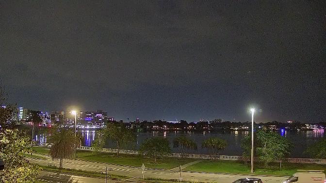
Live Webcam Bayshore Boulevard, Hillsborough Bay, Tampa Bay, Florida - United States

The Geological and Coastal Formation

Hillsborough Bay, cradling the curve of Bayshore Boulevard, is the product of Pleistocene sea‑level fluctuations that sculpted Florida’s west coast. Beneath the surface lies the Ocala Limestone, a porous carbonate bedrock riddled with solution cavities. Over time, siliciclastic sediments—quartz sand and silt carried by rivers—accumulated atop this foundation, giving rise to the bay’s gently shelved profile. The shoreline’s gentle gradient, rarely exceeding a one‑percent slope, allows for extensive intertidal flats where fine sediments settle, promoting the growth of seagrass meadows and mangrove fringes.

Sediment Dynamics and Erosion Control

The bay’s sediment budget is controlled by longshore drift and riverine input. Seasonal northwesterly winds drive a predominant southward littoral current, transporting sand along the coast. To counteract shoreline recession, engineers installed the original seawall in the 1920s, later reinforced with riprap revetments. Periodic dredging of the inner bay channel ensures navigability for small craft, with sediment bypass systems diverting dredged material to downdrift beaches, maintaining equilibrium along the shore.

Seiche and Tidal Patterns

Although Hillsborough Bay experiences a micro‑tidal range of only 0.5 to 1.0 foot, seiche events induced by Gulf swells can amplify water levels by an additional 0.8 foot. These standing-wave oscillations, transmitted through the bay entrance, can cause rapid inundation of low‑lying segments of Bayshore Boulevard during strong northerly gales. Advanced tide gauges along the promenade relay minute‑by‑minute data, enabling proactive closure of flood‑prone pedestrian underpasses.

Early Settlement and Urban Development

Long before asphalt ribboned its edge, indigenous Calusa and Tocobaga peoples regarded the shoreline as a vital fishing ground. Shell middens along today’s Bayshore trace back over a thousand years, marking community sites where oyster and mullet harvests sustained seasonal settlements. These early inhabitants fashioned tools from bone and shell, leaving behind a cultural legacy that now informs archaeological interpretive panels dotting the linear park.

Spanish and Territorial Period

In the 16th century, Spanish explorers charted these calm waters, referring to the bay as “Bahía de San Antonio.” Missionaries established outposts, and modest cattle ranches appeared inland. Following Florida’s transfer to the United States in 1821, the bay became an artery for steamboats ferrying goods between Tampa Bay’s deeper channels and fledgling settlements along the Hillsborough River. Ferry landings near present-day Bayshore Boulevard provided critical connections to Fort Brooke, the military post that evolved into downtown Tampa.

Railroad Era and Growth

The arrival of Henry B. Plant’s railroad in the 1880s accelerated development. A causeway linked the bay’s eastern shore to the barrier islands, facilitating the construction of the Tampa Bay Hotel. Wealthy visitors arrived by rail, disembarked on docks near Bayshore, and promenaded along its softwood boardwalk—an antecedent of today’s multi‑use trail. Large shade trees, including live oaks draped in Spanish moss, were intentionally planted to provide shelter for early automobile parades in the 1910s.

The Construction and Evolution of Bayshore Boulevard

Conceived in the 1920s as a scenic motor route, Bayshore Boulevard was initially a two‑lane concrete roadway atop a low seawall. By the 1930s, a Works Progress Administration project widened the street, extending the seawall northward and creating landfill areas for parkland. Sidewalks were added, and streetlamps installed, giving the boulevard its signature “mile of continuous sidewalk.” The 1950s saw the planting of over 1,000 banyan and ficus trees, forming a canopy arching over the pedestrian path.

The Original Seawall and Roadway

The original seawall consisted of locally quarried coquina blocks, mortared to withstand wave action. Road engineers embedded steel rebar grids within three inches of the concrete surface to control cracking, ensuring the pavement could accommodate the weight of increasing automobile traffic. Historic photos reveal early Model Ts sharing the boulevard with horse‑drawn carriages, a testament to the transitional era of American transportation.

Modern Enhancements and Park Design

Today’s boulevard features a 4.5‑mile recreational trail, delineated for cyclists and pedestrians by thermoplastic striping. Native plant gardens occupy the median, irrigated by reclaimed stormwater. LED streetlights follow a retro‑Victorian style, their 16‑foot poles spaced at 100‑foot intervals to maintain uniform illumination. The park’s design integrates bioswales to filter runoff, reducing nutrient loads to the bay and mitigating algal blooms.

Hydrodynamics and Coastal Engineering

With sea levels rising at approximately three millimeters per year, coastal resilience has become paramount. Engineers are investigating “living breakwaters,” structures composed of concrete modules seeded with oyster spat. These assemblies attenuate wave energy while fostering reef development. Monitoring buoys relay real‑time wave heights and water quality parameters (dissolved oxygen, salinity, temperature), guiding adaptive management of the shoreline.

Bulkheads, Revetments, and Living Shorelines

Private seawalls lining adjacent residential properties utilize vinyl sheet piles driven ten feet into the substrate, backed by inert geotextile membranes to retain fill soils. In contrast, public park edges favor naturalistic coquina rock revetments, overlaid with mangrove propagules to stabilize sediments and create habitat. Where space allows, salt marsh restoration replaces hardened structures, promoting nutrient uptake and providing nursery grounds for juvenile finfish.

Storm Surge and Resilience Measures

Hurricane storm surge studies indicate that Bayshore could experience up to six feet of inundation during a Category 3 event. Remediation plans include elevation of critical roadway segments by up to two feet, installation of deployable floodgates at underpasses, and conversion of low-lying parking areas into temporary water retention basins. Emergency desalination units and mobile substations are pre‑positioned to restore power and potable water swiftly after major storms.

Flora, Fauna, and Ecological Corridors

Between the road and the bay, a green ribbon sustains a surprising biodiversity. Sea purslane and saltwort edge the intertidal zone, transitioning to mangrove scrub and then to live oak hammocks. These vegetation zones buffer wind and waves, sequester carbon, and provide habitat connectivity from upland parks to the bay itself. Pollinator gardens along the trail attract bees, butterflies, and hummingbirds, linking urban green spaces with coastal wetlands.

Mangrove and Seagrass Habitats

Red, black, and white mangroves form an intricate matrix of roots and prop‑roots that trap sediment and reduce turbidity. Beyond the mangrove fringe, extensive seagrass meadows—predominantly turtle grass and manatee grass—enhance water clarity by stabilizing sediments and absorbing excess nutrients. These meadows support manatees, juvenile snook, and a plethora of invertebrates, forming the base of the bay’s food web.

Bird Migration and Marine Life

Bayshore Boulevard is recognized as a prime birdwatching corridor. During winter, flocks of American oystercatchers and black skimmers forage along exposed mudflats. Spring and fall migrations bring dozens of shorebird species, including sandpipers and plovers, stopping to refuel amid the seagrass patches. Bottlenose dolphins frequently patrol the nearshore waters, occasionally leaping in playful arcs that delight morning joggers along the trail.

Recreational and Cultural Landmarks

The linear park hosts an array of organized activities: weekly sunrise yoga, dock‑to‑dock paddle races, and outdoor concerts beneath the Banyan canopy. Mile markers spaced every tenth of a mile offer fitness challenges, while fitness stations intersperse the trail for body‑weight exercise. Historical plaques detail the boulevard’s evolution, and interactive kiosks allow visitors to track their carbon‑offsetting contributions by choosing human‑powered transport over vehicles.

Bayshore Linear Park and Events

One of the marquee events is the annual “Lights Along the Bay,” when seven million LED bulbs trace the boulevard’s outline in December, creating one of the world’s longest continuous holiday light displays. Charity runs and cycling rallies often choose Bayshore for its flat profile and scenic vistas, bringing together thousands for causes ranging from cancer research to environmental awareness.

Art and Community Spaces

Public art installations punctuate the park, from abstract metal sculptures evoking waves to mosaic murals depicting local herons and manatees. A riverside stage supports community theater performances and cultural festivals celebrating the city’s diverse heritage. Street pianists occasionally set up portable keyboards under the icicle lights, their melodies drifting across the bay at dusk.

Surrounding Amenities and Neighborhood Character

Bordering Bayshore Boulevard is one of Tampa’s most prestigious residential districts. Mediterranean Revival and Art Deco homes sit behind manicured hedges, their balconies offering panoramic views of Hillsborough Bay. Condominium towers rise further north, providing residents with boat slips and direct trail access. The neighborhood association maintains strict architectural guidelines to preserve the boulevard’s historic character.

South Tampa Residential Enclaves

Streets intersecting the boulevard—such as Bay Shore Drive and Grand Madeira Avenue—offer hidden pocket parks and private beach accesses. Residents often extend the boulevard’s communal ethos by hosting block‑wide yard sales and food‑truck pop‑ups on weekends, fostering a tight‑knit atmosphere despite the urban setting.

Dining, Arts, and Nightlife Along the Bayfront

A cluster of waterfront cafés and bistros line the boulevard’s southern end, serving Gulf oysters, ceviche, and craft cocktails garnished with local citrus. Patio seating overlooks moored yachts and sailboats drifting at anchor. Nearby art galleries showcase local painters inspired by the shifting light over the bay, while intimate live‑music venues host jazz trios and acoustic singer‑songwriters until the late evening.

Tip: For an unbeatable sunset view, position yourself on the west side of Bayshore Boulevard’s Alaska Drive intersection—this stretch offers an unobstructed panorama, and on clear evenings, you can see sunlight spark off the Sarasota shore across the bay.

Interesting fact: Bayshore Boulevard’s continuous sidewalk was once recognized by the Guinness World Records as the longest pedestrian sidewalk in the world, stretching an impressive 4.5 miles without interruption.