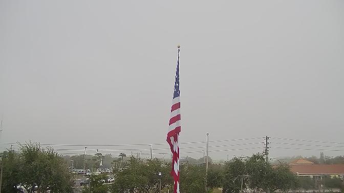
New Port Richey Live Cam
It is a suburban city included in the Tampa-St. Petersburg-Clearwater
History
The land that would become New Port Richey was first inhabited by the Tocobaga people, who thrived along the Pithlachascotee River and the nearby Gulf coast, carving out shell mounds and sustained fisheries more than a thousand years ago. These indigenous communities left behind circular shell middens, now recognized as both archaeological treasures and bird rookeries, evidence of centuries of sustainable use of mangrove estuaries and tidal flats. Spanish explorers passed through the region in the 16th century, mapping the inlet and naming the river “Pithlachascotee,” a term meaning “where boat sank.” Yet the area remained largely unsettled by Europeans until the late 19th century, when the extension of railroad lines into Pasco County opened vast tracts of pine flatwoods for homesteading.
In 1891, settler William Smith arrived by steamship and established the first post office under the name “Port Richey,” honoring Captain Richey, a local lumberman whose schooners hauled longleaf pine to Tampa’s burgeoning sawmills. At that time, the town consisted of a scattering of wooden homesteads, a general store, and a small dock that served as the community’s lifeline to markets downriver. By the early 1900s, agriculture flourished; citrus groves and truck farms spread across sandy ridges, their produce shipped out via rail to northern cities. The virgin pine forests were cut for turpentine and lumber, yielding naval stores that bootstrapped the local economy.
The real transformation occurred in the 1920s, when a wave of developers envisioned Port Richey as a coastal resort rivaling St. Petersburg. Paved boulevards were laid out in grid patterns, including Broadway Avenue and U.S. Route 19, slicing through palmetto scrub and slash pine stands. Mediterranean Revival homes sprang up along tree‑lined streets, their red‑tile roofs visible from steam launches crossing the bay. In 1924, the city incorporated as “New Port Richey,” seeking to distance itself from the older village upriver and to project an image of modernity and affluence.
That same decade saw Hollywood’s hidden gem: New Port Richey became home to a silent‑film colony, attracting stars who built winter retreats on the river’s banks. Mary Pickford and Douglas Fairbanks owned estates nearby, hosting elaborate garden parties and impromptu riverboat excursions. The Pithlachascotee River became a glamorous corridor of houseboats and skiffs, while local entrepreneurs capitalized on celebrity cachet to promote the city as Florida’s “Friendliest Port.” Although the Great Depression curtailed large‑scale development, many of the era’s landmark structures—Mission Revival theatres, art deco facades, and the original River Walk promenade—endured as testaments to that golden age.
Post‑World War II growth brought suburban subdivisions and shopping centers, reshaping New Port Richey’s downtown into a commercial hub for western Pasco County. Yet the city retained its historic core: Victorian‑era cottages mingle with mid‑century ranch homes, and a renewed interest in heritage conservation led to the establishment of the Sims Park Historic District. In recent decades, community efforts have restored riverfront parks, dredged the downtown marina basin, and revived Second Avenue as an arts and dining district, blending the nostalgic charm of the past with contemporary cultural offerings.
Today, the city celebrates its layered past through annual festivals like Chasco Fiesta, rooted in a mythical Native American legend, and the Mayors’ Riverfest, which honors the waterway that shaped its existence. Walking tours led by local historians guide visitors past century‑old oolitic limestone buildings, heritage oak trees, and hidden gardens, weaving a narrative that spans indigenous lifeways, pioneer tenacity, and cinematic allure.
Climate
New Port Richey experiences a humid subtropical climate marked by clear distinctions between wet and dry seasons. From November through April, the dry season prevails, offering mild daytime highs in the upper 60s to mid‑70s Fahrenheit and cool, breezy evenings. The lower humidity levels combine with frequent northerly winds off the Gulf, resulting in pleasant conditions for outdoor exploration and festivals. Winter months see occasional cold fronts that can drop nighttime lows into the 40s, prompting locals to bundle up for sunrise birdwatching along the riverbanks.
The wet season extends from May to October, characterized by daily thunderstorms fueled by intense solar heating and moisture-laden onshore flows. Afternoon showers, often brief yet torrential, replenish wetlands and subdue rising temperatures that peak in the low to mid‑90s. Summer humidity regularly exceeds 70 percent, with heat indices climbing toward triple digits. Lightning safety protocols are strictly observed at outdoor venues and boat docks, where sirens warn of approaching storms and mariners seek shelter behind mangrove barriers.
Hurricane season, spanning June through November, poses the greatest climatic risk. Though New Port Richey lies somewhat inland, the shallow gradient of the coastal plain allows storm surge to travel far upriver, inundating low‑lying neighborhoods and parks. Flood gauges installed at key river crossings provide real‑time stage data, enabling emergency managers to deploy sandbag barriers and initiate voluntary evacuations. Yearly resiliency drills incorporate local meteorological forecasts, refining protocols for power restoration, debris clearance, and water quality monitoring.
Geography
Situated on the western edge of Pasco County, New Port Richey occupies a peninsula bounded by the Pithlachascotee River to the east and northwest Hillsborough Bay to the southwest. The city’s topography is defined by subtle ridges of ancient dunes and intervening freshwater wetlands. Elevations range from sea level along the river’s tidal reaches to about 30 feet atop sandy uplands, where well‑drained soils support oak hammocks and pine flatwoods. This mosaic of ecological communities fosters biodiversity, from salamanders in cypress strands to migrating warblers in the live oak canopy.
The urban grid aligns with the river’s curvature, resulting in angled intersections and triangular green spaces that host pocket parks and community gardens. Major transportation corridors—U.S. 19 and State Road 54—form divergent axes connecting the city to Tampa Bay’s metropolitan area and inland agricultural zones. A network of pedestrian and cycling paths radiates from the downtown core, linking residential neighborhoods to riverfront parks, flea‑market districts, and commercial hubs.
Hydrologically, the river’s tidal influence extends approximately 10 miles upstream, creating a salinity gradient that fluctuates with rainfall and tidal exchange. Freshwater springs—fed by the Floridan Aquifer—inject clear, cool water that buffers temperature extremes and sustains endemic fish species such as redear sunfish and rare blackwater darters. Floodplain wetlands dotted with cypress domes and marsh grasses act as natural sponges, absorbing high‑water events and filtering sediments before they reach the bay.
Geological surveys reveal underlying limestone karst with sinkholes that occasionally collapse, forming small ponds known locally as “blue holes.” These features dot the landscape, influencing stormwater management and necessitating careful engineering for infrastructure projects. Ground‑penetrating radar and borehole drilling inform the placement of foundations for new developments, ensuring stability and mitigating subsidence risk.
The city’s shoreline along Hillsborough Bay comprises mangrove fringes, salt marshes, and engineered seawalls. Living shoreline projects have reintroduced oyster reefs and mangrove plantings, stabilizing eroded banks and providing habitat for juvenile fish and invertebrates. A dedicated canoe trail winds through mangrove tunnels, showcasing the ecological interplay between land and water, while kayak launch sites strategically placed at park edges encourage low‑impact recreation.
Tip: Plan your visit for late winter or early spring to coincide with riverfront festivals, when crisp mornings and mild afternoons make exploring the waterfront boardwalk and attending outdoor concerts a delight.
Interesting fact: New Port Richey’s Chasco Fiesta, established in 1922, predates many of Florida’s major tourism events and is considered one of the state’s oldest continuous community celebrations, drawing thousands with its mythic “Princess Chasco” parade and historic river pageants.