Big Bend Power Station Live Cam

It sits on nearly 1,500 acres on Big Bend Road in Apollo Beach
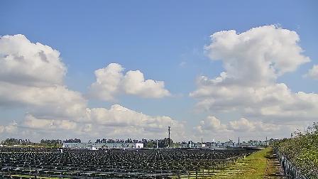
Live Webcam TECO, Hillsborough County, Tampa Bay, Florida - United States

Pre-Columbian Heritage and Geological Formation

The landscape of Apollo Beach and the area across from the Manatee Viewing Center is a study in dynamic coastal geology and millennia of human habitation. Long before modern development, this stretch of shoreline was sculpted by Pleistocene sea-level fluctuations, leaving behind ancient terraces and ridges that now form the backbone of upland habitats. Indigenous peoples, including the Tocobaga and Calusa, established seasonal camps along shallow estuaries, harvesting oysters, mullet, and blue crabs from the intertidal zone. Shell middens, which appear as low mounds of discarded shells and charcoal, attest to centuries of foraging and small-scale horticulture. Beneath the palmetto scrub and slash pine stands, archaeologists uncover fiber-tempered pottery shards and stone tools, confirming sustained occupation from at least 2,000 years ago.

Early European Encounters and Settlement

When Spanish expeditions charted the Gulf Coast in the 16th century, they documented broad inlet systems and navigable rivers feeding into what would become Tampa Bay. The name “Bahía de Espíritu Santo” once encompassed these waters, and the first European maps hint at freshwater springs near present-day Apollo Beach. By the 18th century, British surveyors noted scattered homesteads and cattle herds tended by Scottish and Welsh settlers granted land under the East Florida conditions of land grant policy. These early pioneers cultivated small citrus groves and vegetable plots, relying on rudimentary well systems tapping the Floridan aquifer. Remnants of wooden pier posts, occasionally exposed during low tides, mark historic docking points used for exporting hides and naval stores.

Spanish Influence and Naming of Tampa Bay

Spanish galleons regularly passed offshore, seeking safe harbor in Tampa Bay’s calm waters. Cartographers recorded landmarks such as “Punta del Rio Manatí” for the Manatee River mouth—an early nod to the endemic sea cows. Local folklore suggests that Spanish sailors referred to the east shore as “La Playita,” meaning “little beach,” due to its narrow sandy ribbon backed by coastal hammocks. Over subsequent centuries, names evolved through British and American occupation, eventually settling on modern toponyms like Apollo Beach, a moniker inspired by the 1960s space program’s allure.

Pioneer Homesteads and Agriculture

The 19th-century pioneers transformed hammock edges into small-scale farms, clearing hardwoods for cotton, sugar cane, and later, citrus. Homestead cabins—built from heart pine and cypress—stood on pilings to mitigate seasonal flooding. Ingenious drainage ditches and earthen levees rerouted stormwater away from crop rows. These early agricultural systems foreshadowed today’s engineered stormwater management, where constructed wetlands filter runoff before it enters Tampa Bay. Occasional remnants of hand-dug irrigation trenches surface along nature trails, offering glimpses into the labor-intensive practices of early settlers who contended with mosquitoes, tropical storms, and salt intrusion.

Development of Manatee Viewing Center and Industrial Impact

The modern Manatee Viewing Center owes its existence to the 1960s construction of the Big Bend Power Station, whose warm-water discharge created an unintended winter refuge for manatees. Engineers designed cooling canals and outflow conduits that, during the cooler months, attract hundreds of West Indian manatees seeking temperate waters. Far from purely industrial, the site evolved into an environmental asset. Habitat restoration projects planted submerged aquatic vegetation in settling ponds, and boardwalks with interpretive signage introduced the public to power generation processes and local ecology. What began as a byproduct of energy production has become a cornerstone of ecological tourism.

Formation of the Habitat and Ecosystem Restoration

In collaboration with state wildlife agencies, power plant operators transformed raw discharge basins into living laboratories of restoration ecology. Oyster reefs were established along canal edges using recycled shell, improving water clarity through natural filtration. Wetland islands were constructed to support native marsh grasses and mangrove propagules, expanding nursery grounds for fish and crustaceans. Seasonal guided tours demonstrate how engineered infrastructure can coexist with habitat enhancement, offering visitors a rare glimpse of sustainable industrial design in action.

Apollo Beach Emergence as a Residential and Recreational Hub

As Tampa Bay’s urban core expanded, Apollo Beach emerged in the late 20th century as a planned community blending waterfront living with natural amenities. Residential streets curve around man-made lagoons, each designed to mimic native tidal creeks and accommodate small watercraft. Lot lines were drawn to maximize bay views and private dock access, while upland parcels retained hammock corridors for wildlife movement. Early developers implemented architectural guidelines encouraging Lowcountry-style homes with raised foundations, metal roofs, and deep porches—design features that reflect both aesthetic cohesion and practical responses to coastal climate challenges.

Urban Planning and Infrastructure

Infrastructure planning prioritized resilience against hurricanes and storm surge. Roadways are elevated two feet above historic flood levels, and stormwater swales line residential blocks, channeling runoff into retention ponds before gradual release. The municipal water system sources from deep Floridan aquifer wells, blending treated well water with surface water reserves to meet peak seasonal demand. Underground utility corridors minimize visual clutter and reduce outage risks during high winds. Community planning integrated walkable commercial zones, ensuring amenities like grocery stores, marinas, and athletic clubs are accessible without reliance on highways.

Transportation Networks and Public Access

Apollo Beach’s main thoroughfare, Mathog Road, connects residents to U.S. Highway 41 and Interstate 75, linking the community to Downtown Tampa and Sarasota within a 45-minute drive. Dedicated bike lanes and pedestrian paths run parallel to key roads, encouraging non-motorized travel. A seasonal water taxi service ferries visitors across the bay to the Manatee Viewing Center, providing an eco-friendly transit option and stunning panoramas of the power station’s cooling canal system.

Cultural and Community Activities

Community centers host monthly environmental workshops, beach cleanups, and estuary picnics sponsored by local conservation organizations. Annual seafood festivals celebrate Gulf harvests—stone crab claws, grouper sandwiches, and clam chowder prepared from catch landed nearby. Outdoor art installations, often crafted from driftwood and repurposed marine hardware, reflect the area’s maritime heritage. Local libraries organize “Manatee Mondays,” where rangers and biologists speak about marine mammal biology and conservation, fostering a sense of stewardship among residents and visitors alike.

Eco-Tourism and Wildlife Encounters

Apollo Beach is an epicenter for eco-tourism, drawing naturalists, photographers, and families eager to observe Florida’s signature megafauna. Guided kayak tours navigate shallow channels fringed by buttonwood and black mangrove, offering intimate views of ospreys, herons, and occasionally, elusive roseate spoonbills. Snorkeling excursions reveal seagrass meadows supporting juvenile fish and invertebrates. Interpretive guides share technical insights into salinity gradients, turbidity layers, and tidal exchange, enriching the excursion with scientific context and fostering deeper appreciation of estuarine processes.

Manatee Conservation Efforts

The Manatee Viewing Center operates under a permit that balances public education with wildlife protection. Docking areas and viewing platforms are set back to minimize disturbance, and feeding of wild manatees is strictly prohibited. Research teams affix temporary satellite tags to select individuals, tracking their seasonal movements and informing policy on warm-water refuge preservation. Data gleaned from telemetry studies has guided the installation of exclusion devices on power plant canals, preventing manatees from entering hazardous zones.

Birdwatching and Aquatic Flora

Beneath towering slash pines, freshwater marsh margins support cattails and pickerelweed, attracting marsh wrens and red-winged blackbirds. Tidal impoundments within the habitat restoration area serve as prime shorebird foraging sites during migration, hosting sandpipers, plovers, and stilts. Botanical surveys record the presence of rare seabeach amaranth on open sandy spits, while volunteers monitor the spread of invasive Brazilian pepper and coontie moth predation on native cycads. This ongoing citizen-science initiative unites recreation with conservation in a meaningful way.

Tip for the Savvy Traveler

Plan your visit during the cooler months—November through March—when manatee aggregations peak and mosquito activity diminishes. Arrive by mid-morning to catch the most active wildlife and to take advantage of lower sun angles for photography. Bring polarized sunglasses and a telephoto lens to reduce glare on the water and to capture detailed shots of marine mammals without encroaching on their space.

Interesting Fact

The Manatee Viewing Center was the first industrial site in the United States to receive designation as an official manatee refuge, demonstrating that power generation facilities and wildlife conservation can coexist in a mutually beneficial partnership.