The Riverhouse Palmetto Live Cam

A unique waterfront dining experience to Palmetto’s historic district
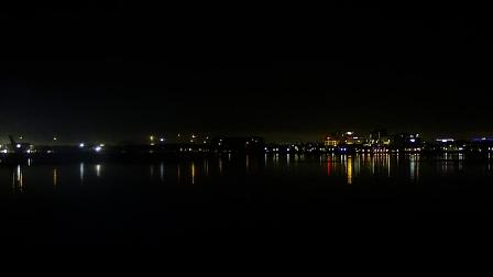
Live Webcam The Riverhouse Palmetto, Florida - United States

The Geological Origins

Beneath the placid surface of the Manatee River lies a story that begins in the late Pleistocene epoch, when shifting shorelines and fluctuating sea levels sculpted the ancient carbonate platforms of what is now Florida’s Gulf Coast. The river occupies a drowned karst valley, carved into Ocala Limestone—a formation composed largely of ooid-rich grainstones. Over successive glacial cycles, marine transgressions and regressions deposited layers of quartz sand and shell hash, creating a substratum that today underpins the river’s meandering course.

Subtidal channels within the lower reaches cut through a veneer of Holocene muds and silts, remnants of the estuarine environment that thrives at the river’s brackish confluence. This interplay between hard limestone banks and softer alluvial deposits yields a variety of bank profiles—from sheer limestone escarpments to gently sloping, mangrove-lined shores—each reflecting subtly different erosion rates and sediment transport dynamics.

Karst Topography and Groundwater Interactions

The watershed feeding the Manatee River is riddled with sinkholes and springs characteristic of karst terrain. Cold-water springs emerge where the Floridan Aquifer intersects the land surface, injecting clear, mineral-rich water that moderates river temperatures and fosters unique ecological niches. Recreational paddlers often pause at DeSoto Springs to peer into cavernous openings, where scalloped limestone walls descend into darkness.

Spring Discharge Patterns

Flow from these springs remains remarkably stable, averaging 68 million gallons per day year‑round. This constant discharge not only buffers the river against drought-induced low flows but also influences nutrient cycling, as groundwater-borne phosphates and carbonates interact with tidal saltwater during hourly inundation events.

Hydrodynamics and Estuarine Processes

The Manatee River transitions from a freshwater fluvial system upstream of the U.S. 41 highway bridge into a mesohaline estuary as it approaches Tampa Bay. Tidal exchange propagates nearly 25 miles inland, with a typical tidal amplitude of 1.0 to 1.3 feet. However, wind-driven seiches and meteorological tides driven by Gulf storms can temporarily amplify levels by over two feet, surging saltwater upstream and reshaping sediment deposits.

Salt Wedge Dynamics

During periods of low river discharge, a classic salt wedge forms, with denser Gulf water intruding beneath the outflowing fresh river water. This stratification creates a sharp pycnocline at depths of 5 to 10 feet, challenging boat operators who must navigate a hidden density interface that can alter boat handling characteristics and increase fouling rates on submerged hull surfaces.

Seasonal Flow Variability

Rainfall patterns in the subtropical climate drive peak flows from June through September, coinciding with the Atlantic hurricane season. The resulting pulse of freshwater not only refreshes estuarine habitats but also flushes accumulated organic material downstream, feeding the bay’s planktonic communities. Conversely, in winter months, reduced flow and northward winds push saline water farther inland, impacting freshwater-dependent species.

Historical Layers Along the Riverbanks

Archaeological surveys along the Manatee River’s banks have unearthed shell middens and pottery shards dating back over a thousand years, testifying to the pre-Columbian presence of the Safety Harbor culture. Paddle-crafted canoes would glide these waters, allowing indigenous communities to fish mullet and spear catfish in the shallows. Today, interpretive kiosks at Emerson Point Preserve guide visitors through the remnants of earthen mounds and fortifications, preserving the narrative of early riverine life.

European Exploration and Colonial Footprints

The first European to document the river was Spanish explorer Hernando de Soto in 1539, who noted its abundant freshwater springs and strategic importance. During the British period (1763–1783), timber logging camps sprouted along its banks, harvesting longleaf pines floated downstream to mills in Bradenton. Remnants of narrow-gauge tramways and sawmill footings can still be spotted by keen-eyed kayakers tracing the river’s upper reaches.

Civil War Era and Beyond

In the Civil War, blockade runners used the river’s twisting bends to slip past Union patrols, depositing goods for sympathetic residents upriver. After the war, the arrival of the railroad in the 1880s transformed the economy: citrus groves and pineapple fields emerged on floodplain terraces, their success owed in part to the nutrient-rich overbank deposits delivered during seasonal floods.

Modern Infrastructure and Riverfront Development

Bridges spanning the Manatee River blend engineering prowess with aesthetic consideration. The Manatee Avenue Bridge employs a bascule design, allowing the 50-foot channel to remain open for vessel traffic. Its hydraulic counterweights and twin leaf spans rise in under 60 seconds, coordinating with marine lore that larger sailboats require a minimum of 35 feet of vertical clearance.

Stormwater Management and Water Quality Efforts

Urban growth in Palmetto and Bradenton challenged the river’s health, but since the 1990s, comprehensive stormwater treatment ponds and vegetated swales have captured run-off before it enters the mainstem. Nutrient loads are reduced through denitrification in constructed wetlands; phosphorus binds to oyster shell and marl substrates in living shoreline projects, restoring water clarity and enhancing habitat complexity.

Marinas and Navigation Aids

The Riverfront Marina in Palmetto features floating concrete docks, shore-power pedestals, and a viewing pier aligned with a series of buoys marking the safe channel. LEDs atop the buoys switch from green to red in response to tidal direction, a smart system that integrates with NOAA’s tidal predictions, guiding boaters through the shifting sandbars that characterize the lower river.

Ecology, Flora, and Fauna

A tapestry of habitats unfolds along the river margins: hardwood hammocks of live oak and cabbage palm give way to cypress swamps upstream, where knees of Taxodium distichum peek above slow-moving waters. Closer to the estuary, mangrove stands of red and black mangrove stabilize shorelines and serve as nurseries for gamefish. Submerged aquatic vegetation—predominantly shoal grass—beds intercept sediments, improving water clarity and nutrient uptake.

Fish Populations and Fisheries

The Manatee River supports both freshwater and saltwater fisheries. Channel catfish and largemouth bass dominate upstream angling reports, while downstream, anglers pursue snook, redfish, and spotted seatrout. Seasonal closures protect spawning aggregations; biotelemetry studies track redfish movements through the river corridor, revealing home ranges that span several miles of channel.

Avifauna and Migratory Corridors

Birdwatchers flock to Robinson Preserve and Gamble Plantation State Park, nestled along river bends. Here, wading birds like great egrets, snowy herons, and roseate spoonbills forage along exposed flats. Twice annually, migratory warblers and shorebirds pause in the riverine forests, replenishing energy before continuing journeys to Central and South America.

Recreation, Culture, and Riverfront Engagement

Kayak and paddleboard rentals along the Palmetto riverfront invite visitors to explore side channels and secluded coves. Guided eco-tours spotlight manatees that linger in warm spring-fed pools during winter months, and dolphins that chase mullet schools near the mouth. The river also hosts competitive events, such as the Palmetto Dragon Boat Festival, where crews race sleek vessels in synchronized paddling feats.

Cultural Festivals and Community Events

Each spring, the Palmetto Bluegrass & Folk Festival transforms the waterfront park into a stage for regional musicians, their melodies mingling with the lapping of water against bulkheads. Local artists display river-themed works—from driftwood sculptures to watercolor paintings—celebrating the Manatee River’s enduring influence on community identity.

Dining and Riverfront Strolling

Riverside cafés and bistros line U.S. 41, offering views of passing houseboats and sailboats silhouetted against a golden sunset. Menus emphasize seasonal produce—Gulf oysters, Florida strawberries, and key limes—paired with craft beers and regional white wines. Brick-paved promenades invite leisurely evening strolls, punctuated by informational murals that chronicle the river’s history in vivid, hand-painted panels.

Tip: Arrive at Emerson Point Preserve just before dawn to hitch a guided paddle through its narrow mangrove tunnels—this early light illuminates the river’s glass-like surface and maximizes sightings of ospreys diving for fish.

Interesting fact: The Manatee River once served as the county line between Manatee and Sarasota Counties, a boundary marked not by surveyed stakes but by a single wooden post driven into the east bank in 1905—still visible today, albeit weathered, near the mouth of Hawkins Creek.